vdPClassify, migration phase

vdPClassify has been developed to provide information on DWG-elements to be stored in a migration scheme and also to capture the ‘mapping’ to the appropriate database tables and attributes. vdPClassify is a .NET utility available for various AutoCAD versions and can process a folder with AutoCAD & AutoCAD Map DWG’s and MicroStation DGN’s.

From the vdPClassify analysis, the filters in the migration control table are made:

  • Is the layer name equal to “Cables_OV”?
  • Is there objectdata linked with the tablename “Cables”?
  • Then the object is a “Cable_OV” feature.

Next, information from the objects is read using powerful property filters.

  • Geometry from the coordinates.
  • Unique ID from AutoCAD handle.
  • Theme-name is directly in the control table.
  • Material from object data.
  • etc.

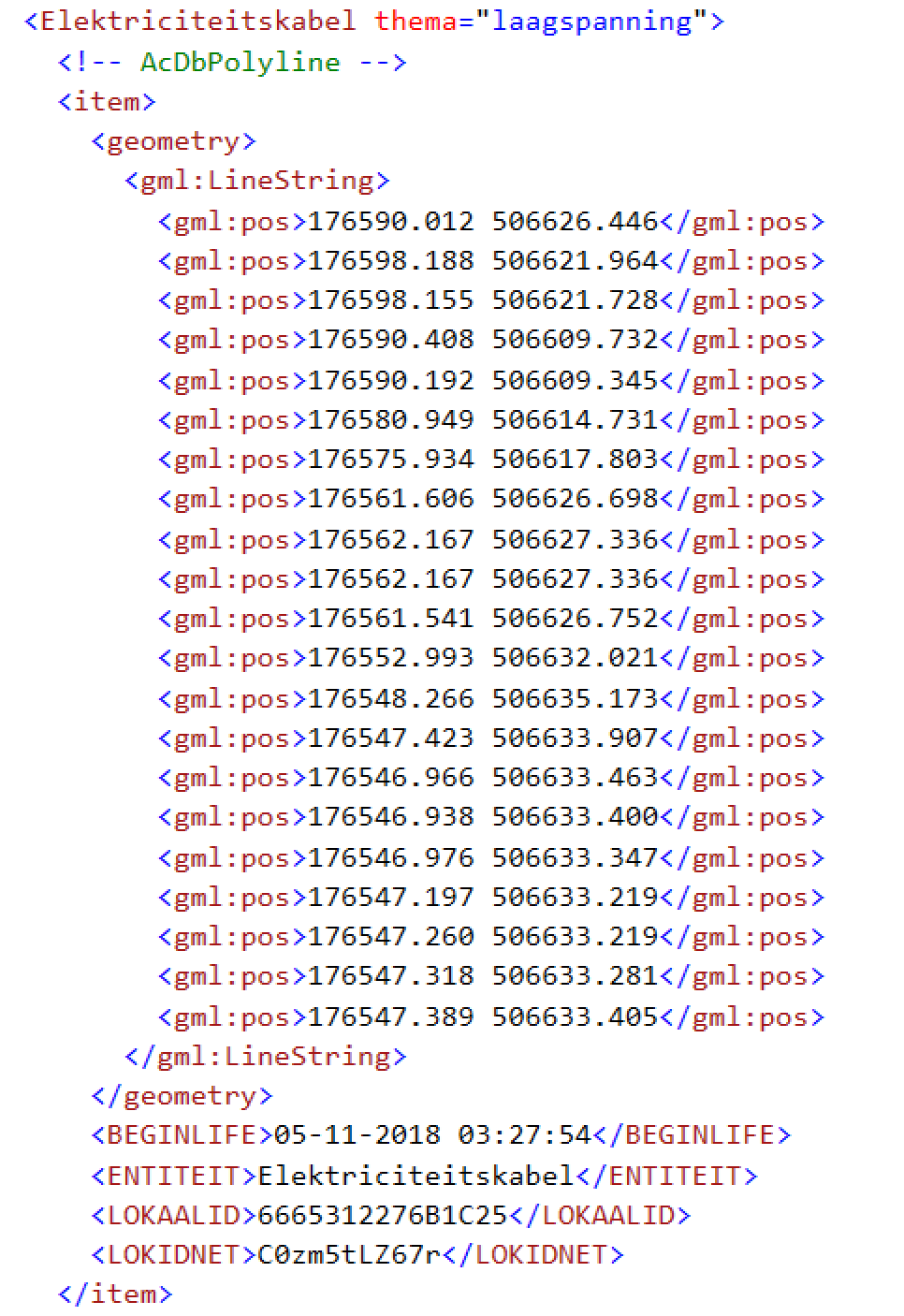
As an example, the result of one AutoCAD-polyline written to GML with limited IMKL-information.

More information?
Ask the cadgis-consultant

vdPClassify, analysis phase

vdPClassify has been developed to provide information on DWG-elements to be stored in a migration scheme and also to capture the ‘mapping’ to the appropriate database tables and attributes. vdPClassify is a .NET utility available for various AutoCAD versions and can process a folder with AutoCAD & AutoCAD Map DWG’s and MicroStation DGN’s.

The first step in a vdPClassify project is an onsite analysis of the CAD-drawingfiles. With the help of functions from the vdPClassify-toolkit, one of our consultants can analyze information about the drawing(s). Think of an overview of the layernames that are in use, what kind of elements are on these layers and is information linked to these elements in the form of xdata or objectdata. If a classification can be derived from the structure of the layernames, does color or linetype tell something about the status of the object, etc.

Based on this information, the smart data filters can be built with which the desired objects from the drawing(s) can be filtered.

More information?
Ask the cadgis-consultant

vdPClassify, introduction

vdPClassify has been developed to provide information on DWG-elements to be stored in a migration scheme and also to capture the ‘mapping’ to the appropriate database tables and attributes. vdPClassify is a .NET utility available for various AutoCAD versions and can process a folder with AutoCAD & AutoCAD Map DWG’s and MicroStation DGN’s.

vdPClassify is currently being used for data migration projects for the WIBON (= Information Exchange Act above and underground networks).
By means of smart data filters, objects from the drawings are filtered. Next, information from the objects is read using powerful property filters.

In general you can recognize objects in a CAD-drawing by a combination of entitytype and layername, linetype or blockname. With this combination the IMKL-objecttype can be determined. In addition, CAD-elements contain information in the form of blockattributes, xdata or object data. This information can be converted to IMKL-attributes.

vdPClassify consists of a consulting-toolkit. With which we can perform an onsite analysis, create a migration control table and write the data in the desired format.
Users can then independently perform the conversions using the vdPClassify-runtime.

More information?
Ask the cadgis-consultant

NEN2580 Reportservice

One of the projects vdPConsulting has been working on – as a subcontractor – is the NEN2580 Reportservice.

The system consists of a C# application in Autodesk Revit that can classify projects and create a NEN2580 compatible report using a webservice.


For more details take a look here at the NEN website ( in Dutch ),

AutoCAD Map/FDO – Spatial Query with displayMngr plugin

Spatial QueryGenerally GIS-data is available on a complete other scale than CAD-users need for their projects.

Importing that GIS-dataset into a CAD-environment gives an overkill of data. It would be very useful to add connections to the feature layers in GIS, limited to the area needed for the project.

This is possible by using AutoCAD Map/FDO Data Connect and a Spatial Query. But this is not very user friendly. That is why vdPConsulting has developed a displayMngr plugin.

This is the workflow:

  • Make sure that the desirable feature layers are connected, by using a pre-defined template or so called .layer files.
  • Load the displayMngr plugin.
  • Start the command “filterWindow” or “filterCrossing”.
  • Indicate the desirable area by picking two points on the map.
  • The plugin creates the SQL filter statements and “inject” these into the definitions of the connected feature layers.

If you want more information about using AutoCAD Map/FDO and GIS-databases or the displayMngr plugin, please contact me.